Glacier monitoring
Glaciers are traditionally of great scientific and economic interest in Switzerland. Glacier changes are considered one of the best indicators to detect climatic fluctuations. The glaciers as water reservoir play an important role for the economic use (drinking water, power generation). In addition, the decline in glaciers also has a significant impact on tourism, and natural hazards in the mountains (ice avalanches, lake outbursts) are often associated with glaciers.
The programme external page Glacier Monitoring in Switzerland (GLAMOS) aims at the long-term study of glacier changes in the Swiss Alps. The service is maintained by our group at ETH Zurich, and involves the Department of Geosciences of the University of Fribourg, as well as the Department of Geography of the University of Zurich. The monitoring is coordinated by the Cryospheric Commission of the Swiss Academy of Sciences (CC/SCNAT) and receives financial support from the Federal Office for the Environment FOEN, MeteoSwiss within the framework of GCOS Switzerland, and the Swiss Academy of Sciences (SCNAT). Additional support is provided by the Federal Office of Topography swisstopo.
Measurements of glacier length changes are carried out every year at the tongues of more than hundred glaciers, providing an overview of the long-term changes in Swiss glaciers. More complex methods are used to measure the mass balance both at the end of winter and in autumn, and the surface movement on selected glaciers (for example, the Great Aletsch, Allalin, Clariden, Basòdino, Giétro, Gries, Plaine Morte, Silvretta glaciers). With the help of data from the Federal Office of Topography, the change in ice volume for a larger number of glaciers at intervals of 5–10 years is determined and a new inventory of all glacier areas is regularly compiled.
The data collected by GLAMOS are made available to both the research community and the general public through an annual press release, the bi-yearly external page Glaciological Reports, and the external page GLAMOS data portal.
The external page Swiss Permafrost Monitoring Network (PERMOS) systematically documents the state and changes of mountain permafrost in the Swiss Alps. Data gathered and managed by PERMOS include ground temperature measurements in boreholes, geo-electrical surveys measuring changes in ice and water content, and velocities of permafrost creep.
PERMOS is a joint effort by the Universities of Fribourg, Lausanne and Zurich, ETH Zurich, the University of Applied Sciences and Arts of Southern Switzerland SUPSI, and the Swiss Federal Institute for Forest, Snow and Landscape Research WSL.
In the frame of PERMOS, we contribute surface and subsurface temperature data from two rock glacier sites in the Canton of Grisons, Switzerland: The Muragl and Murtèl rock glacier sites. These boreholes were drilled in 2000 by ETH’s Chair for Geotechnical Engineering and temperature data has been recorded continuously since then. The long-term measurements are used for identifying trends in the evolution of permafrost, and are essential for calibrating and validating numerical models that project future permafrost changes. All data are openly accessible and retrievable from the external page PERMOS Borehole Data Browser.
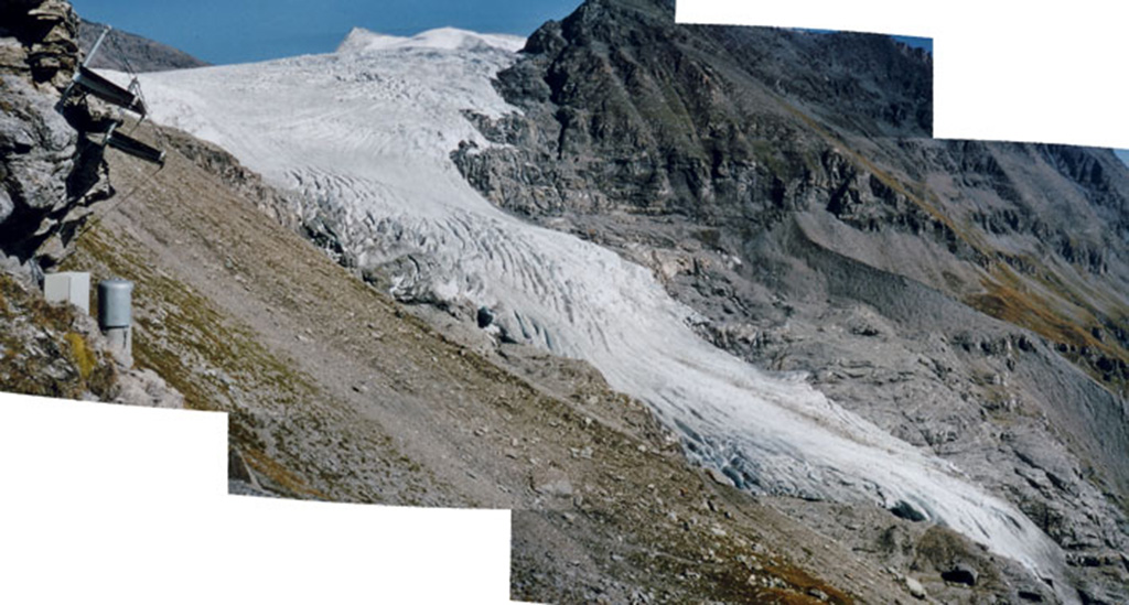
Glacier de Corbassière with a length of 9.8 km and an area of 18.2 km2 is one of the largest glaciers in the Swiss Alps. The steep tongue of Glacier de Giétro (4.3 km long, covering an area of about 5.5 km2) flows over cascades and ends about 500 m above the bottom of the main valley. During the Little Ice Age, at the end of the 16th and beginning of the 19th century, the glacier advanced over steep valley sides. The river in the main valley was occasionally dammed by accumulated ice blocks after break-offs.
In 1595 and 1818 large water outbursts started catastrophic splash floods causing large damage down to the Rhone valley. Since the construction of the Mauvoisin reservoir in 1957 break-offs of large ice masses may cause an oversplash over the dam at times when the reservoir is nearly filled. The safety of the installation is of main interest and requires a continuous supervision.
The glaciers have been monitored intensively since the 1960's. Measurements of mass balance, flow movement, and volume changes document the general variations of the glaciers. Automatic observation systems have been developed in order to measure the surface displacement continuously and detect short-term changes of flow behaviour. Over more than 2 decades a total station (motorized theodolite with distance meter) that automatically follows several moving targets was operated by a telemetric data transmission. This system has recently been replaced by time-lapse photography allowing the monitoring of both ice flow and structures at surface over a larger area.
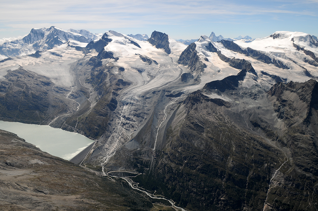
There are several larger glaciers situated in the Mattmark area, including Allalingletscher, Hohlaubgletscher and Schwarzberggletscher, amongst others. Fluctuations of Allalingletscher repeatedly interfered with human activity in the valley. During the Little Ice Age, for example, the terminus dammed the valley's river (the Saaser Vispa) forming a lake. Occasional drainage of the ice-dammed lake caused serious damages in the Saaser valley. Later, during the construction of the Mattmark reservoir in 1965, an ice-avalanche broke off at the glacier terminus. The event destroyed the construction site and killed 88 workers. A similar break-off happened in 2001, fortunately not causing damage.
In order to support the safety of the local hydropower company managing the energy production in the Mattmark area, a glaciological monitoring program is conducted. The evolution of the glacier terminus of the glaciers Allalin, Chessjen, Hohlaub, Schwarzberg and Seewjinen is documented annually. Measurements of ice flow and mass balance are registered at selected locations. The photogrammetrical analysis of the surface topography in regular intervals allows the determination of ice volume changes. Lastely, the seasonal evolution of the glacier terminus and in the forefield of Allalingletscher is monitored with daily time-lapse photography. These measurements are aimed at recognizing potentially-dangerous glacier behaviour at an early stage.